


Have a news item you would like featured? Fill out the request here (UW NetID Restricted).
-
Bridging Observational and Computational Seismology
Thursday, October 14, 2021
NSF is funding Seismic Computational Platform for Empowering Discovery (SCOPED) to support the cyberinfrastructure development of a computational and data platform for large-scale seismology. UW assistant professor Marine Denolle will lead the development of cloud computing for seismology. Read More -
Prof. Bergantz to receive Norman L. Bowen Award from AGU
Wednesday, October 6, 2021
Prof. George Bergantz is to receive the Norman L. Bowen Award at the American Geophysical Union Meeting in December. The Bowen Award is given in recognition of outstanding contributions to the fields of volcanology, geochemistry, and petrology. Read More -
How 'ice needles' weave patterns of stones in frozen landscapes
Wednesday, October 6, 2021
Nature is full of repeating patterns that are part of the beauty of our world. An international team, including a researcher from the University of Washington, used modern tools to explain re!peating patterns of stones that form in cold landscapes.

Circles of stones in Svalbard, Norway. Each circle measures roughly 10 feet, or 3 meters, across. New research provides insight into how these features form in rocky, frost-prone landscapes.Bernard Hallet/University of Washington
The new study, published Oct. 5 in the Proceedings of the National Academy of Sciences, uses experimental tools to show how needles of ice growing randomly on frozen ground can gradually move rocks into regular, repeating patterns. The team, based mainly in China and Japan, uses a combination of novel experiments and computer modeling to describe these striking features with new theoretical insights.
"The presence of these amazing patterns that develop without any intervention from humans is pretty striking in nature," said co-author Bernard Hallet, a UW professor emeritus of Earth and space sciences and member of the Quaternary Research Center. "It's like a Japanese garden, but where is the gardener?"

Lines of stones in Hawaii. Repeated freeze-thaw cycles create lines when the stones are on more steeply sloping ground.Bernard Hallet/University of Washington
Hallet specializes in studying the patterns that form in polar regions, high-mountain and other cold environments. One of the reasons for the patterns is needle ice. As the temperature drops, the moisture contained in the soil grows into spikes of ice crystals that protrude from the ground.
"When you go out in the backyard after a freezing night and you feel a little crunch under the foot, you're probably walking on needle ice," Hallet said.
As needle ice forms it tends to push up soil particles and, if there are any, small stones. More needle ice can form on patches of bare soil compared to rock-covered areas, Hallet said. The ice needles will slightly displace any rema!ining stones in the barer region. Over years, the stones begin to cluster in groups, leaving the bare patches essentially stone-free.
"That kind of selective growth involves interesting feedbacks between the size of the stones, the moisture in the soil and the growth of the ice needles," Hallet said.

Labyrinths of stones in Svalbard, Norway. Labyrinth patterns form where the stones are on a gentle slope. New research provides insight into how these features form in rocky, frost-prone landscapes.Bernard Hallet/University of Washington
In separate work, Hallet is collaborating with NASA on the Mars science mi!ssion to interpret the patterns seen on the surface of Mars and deduce what they reveal about the Martian environment.Hallet had previously reviewed another scientific paper by first author Anyuan Li, formerly at Shaoxing University and now at the University of Tsukuba in Japan. The two began a collaboration that mixes Hallet's longtime expertise investigating patterns in nature with Li and his collaborators' background in experimental science and computer modeling.
Senior author Quan-Xing Liu at East China Normal University uses fieldwork and lab experiments to understand self-organized patterns in nature. For this study, the experimental setup was a flat square of wet soil a little over 1 foot on each side (0.4 meters) that began with stones spaced uniformly on the surface. The researchers ran the exper!iment through 30 freeze-thaw cycles. By the end of that time, regular patterns had started to appear.
"The videos are pretty striking, and they show that the ice just comes up and in a single cycle it pushes up stones and moves them slightly to the side," Hallet said. "Because of those experiments and the abilities of the individuals involved to analyze those results, we have much more tangible, quantitative descriptions of these features."
Further experiments looked at how the pattern changed depending on the concentration of stones, the slope of the ground, and the height of the ice needles, which is also affected by the stone concentration. Based on those results, the authors wrote a computer model that predicts what patterns will appear depending on the concentration of stones on the frost-prone surface.

Two different computer models predict the long-term distribution of stones on freezing ground depending on the stones!' initial concentration. The left column starts with 20% stone coverage, which creates islands, shown here in white; the middle rows have 30% and 40% stone coverage, which creates labyrinths and worm-like shapes; and the fourth column is 80% stone coverage, which gives no pattern. The right column shows 20% stone coverage on a slightly sloping ground; the stones tend to form lines.Li et al./PNAS
Other co-authors on the new study are Norikazu Matsuoka at the University of Tsukuba; Fujun Niu at the South China University of Technology; Jing Chen and Wensi Hu at East China Normal University; Desheng Li at Shanghai Jiao Tong University in China; Johan van de Koppel at the University of Groningen in The Netherlands; and Nigel Goldenfeld at the University of California, San Diego.
The research was funded by the Second Tibetan Plateau Scientific Expedition and Research program; the Japan Society for the Promotion of Science; the Nati!onal Natural Science Foundation of China; the Chinese Academy of Sciences; and the China Scholarship Council.
For more information, contact Hallet at hallet@uw.edu or Liu at liuqx315@gmail.com. Also see a Chinese press release: http://news.sciencenet.cn/htmlnews/2021/10/466403.shtm
Read More -
How 'ice needles' weave patterns of stones in frozen landscapes
Wednesday, October 6, 2021
Circles of stones in Svalbard, Norway. Each circle measures roughly 10 feet, or 3 meters, across. New research provides insight into how these features form in rocky, frost-prone landscapes.Bernard Hallet/University of Washington
Nature is full of repeating patterns that are part of the beauty of our world. An international team, including a researcher from the University of Washington, used modern tools to explain re!peating patterns of stones that form in cold landscapes.
The new study, published Oct. 5 in the Proceedings of the National Academy of Sciences, uses experimental tools to show how needles of ice growing randomly on frozen ground can gradually move rocks into regular, repeating patterns. The team, based mainly in China and Japan, uses a combination of novel experiments and computer modeling to describe these striking features with new theoretical insights.
"The presence of these amazing patterns that develop without any intervention from humans is pretty striking in nature," said co-author Bernard Hallet, a UW professor emeritus of Earth and space sciences and member of the Quaternary Research Center. "It's like a Japanese garden, but where is the gardener?"
Lines of stones in Hawaii. Repeated freeze-thaw cycles create lines when the stones are on more steeply sloping ground.Bernard Hallet/University of Washington
Hallet specializes in studying the patterns that form in polar regions, high-mountain and other cold environments. One of the reasons for the patterns is needle ice. As the temperature drops, the moisture contained in the soil grows into spikes of ice crystals that protrude from the ground.
"When you go out in the backyard after a freezing night and you feel a little crunch under the foot, you're probably walking on needle ice," Hallet said.
As needle ice forms it tends to push up soil particles and, if there are any, small stones. More needle ice can form on patches of bare soil compared to rock-covered areas, Hallet said. The ice needles will slightly displace any rema!ining stones in the barer region. Over years, the stones begin to cluster in groups, leaving the bare patches essentially stone-free.
"That kind of selective growth involves interesting feedbacks between the size of the stones, the moisture in the soil and the growth of the ice needles," Hallet said.
Labyrinths of stones in Svalbard, Norway. Labyrinth patterns form where the stones are on a gentle slope. New research provides insight into how these features form in rocky, frost-prone landscapes.Bernard Hallet/University of Washington
In separate work, Hallet is collaborating with NASA on the Mars science mi!ssion to interpret the patterns seen on the surface of Mars and deduce what they reveal about the Martian environment.Hallet had previously reviewed another scientific paper by first author Anyuan Li, formerly at Shaoxing University and now at the University of Tsukuba in Japan. The two began a collaboration that mixes Hallet's longtime expertise investigating patterns in nature with Li and his collaborators' background in experimental science and computer modeling.
Senior author Quan-Xing Liu at East China Normal University uses fieldwork and lab experiments to understand self-organized patterns in nature. For this study, the experimental setup was a flat square of wet soil a little over 1 foot on each side (0.4 meters) that began with stones spaced uniformly on the surface. The researchers ran the exper!iment through 30 freeze-thaw cycles. By the end of that time, regular patterns had started to appear.
"The videos are pretty striking, and they show that the ice just comes up and in a single cycle it pushes up stones and moves them slightly to the side," Hallet said. "Because of those experiments and the abilities of the individuals involved to analyze those results, we have much more tangible, quantitative descriptions of these features."
Further experiments looked at how the pattern changed depending on the concentration of stones, the slope of the ground, and the height of the ice needles, which is also affected by the stone concentration. Based on those results, the authors wrote a computer model that predicts what patterns will appear depending on the concentration of stones on the frost-prone surface.
Two different computer models predict the long-term distribution of stones on freezing ground depending on the stones!' initial concentration. The left column starts with 20% stone coverage, which creates islands, shown here in white; the middle rows have 30% and 40% stone coverage, which creates labyrinths and worm-like shapes; and the fourth column is 80% stone coverage, which gives no pattern. The right column shows 20% stone coverage on a slightly sloping ground; the stones tend to form lines.Li et al./PNAS
Other co-authors on the new study are Norikazu Matsuoka at the University of Tsukuba; Fujun Niu at the South China University of Technology; Jing Chen and Wensi Hu at East China Normal University; Desheng Li at Shanghai Jiao Tong University in China; Johan van de Koppel at the University of Groningen in The Netherlands; and Nigel Goldenfeld at the University of California, San Diego.
The research was funded by the Second Tibetan Plateau Scientific Expedition and Research program; the Japan Society for the Promotion of Science; the Nati!onal Natural Science Foundation of China; the Chinese Academy of Sciences; and the China Scholarship Council.
For more information, contact Hallet at hallet@uw.edu or Liu at liuqx315@gmail.com. Also see a Chinese press release: http://news.sciencenet.cn/htmlnews/2021/10/466403.shtm
Read More -
Remembering Dr. J Dungan Smith (1939-2021)
Monday, September 20, 2021
Dr. James Dungan Smith is remembered as a great mentor, advisor, scholar, a brilliant and versatile scientist, and a loving father, grandfather and husband. Read More -
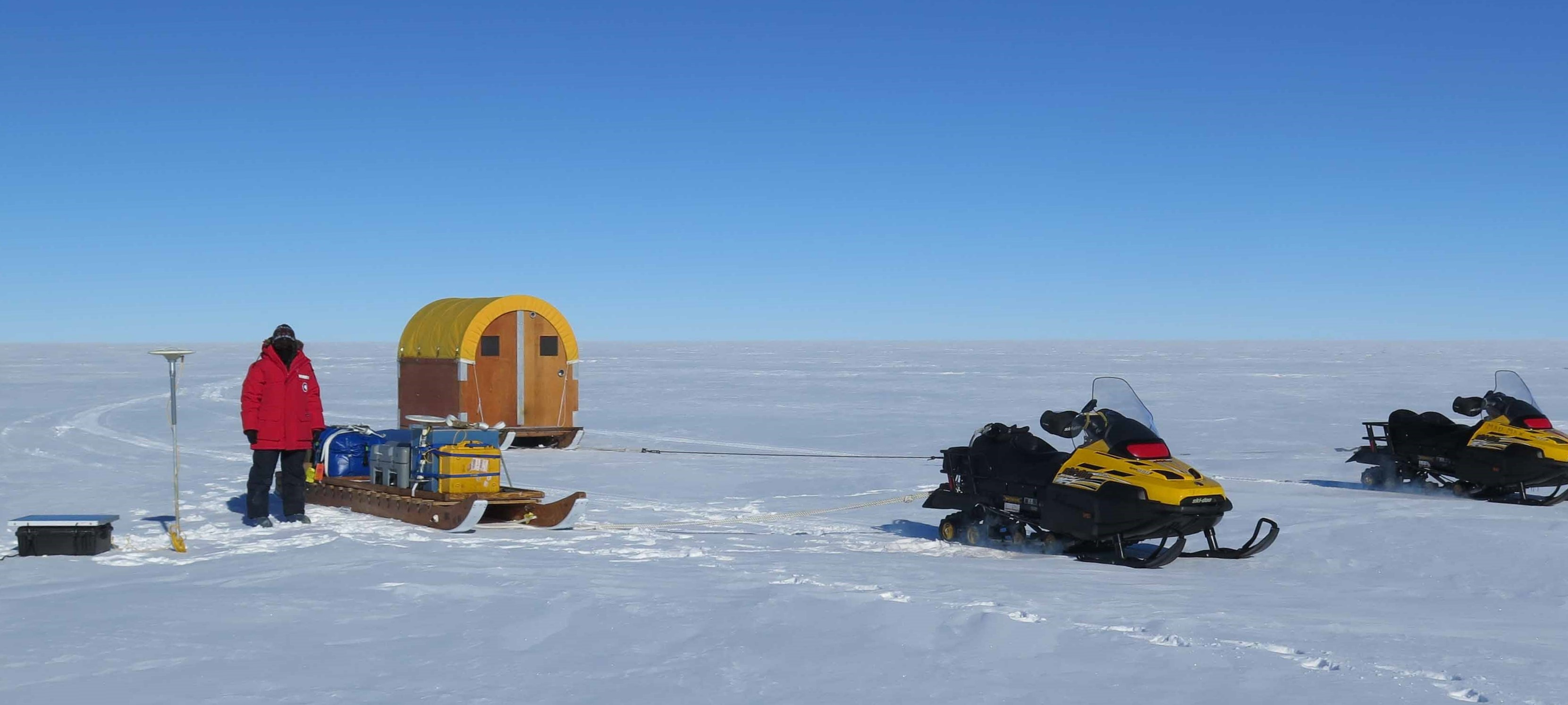
UW part of $25M NSF-funded effort to retrieve Earth's oldest ice core
Tuesday, September 14, 2021
University of Washington glaciologists will join colleagues from around the country in a ne!w effortto discover Antarctica's oldest ice and learn more about the history of our planet's climate.

Ice from a more than 1-mile-deep ice core drilled at the South Pole in 2016. That ice extended back more than 54,000 years, while the new effort aims to find an Antarctic ice record that goes back 1.5 million years.T.J. Fudge/University of Washington
The new Center for Oldest Ice Exploration, or COLDEX, will be created under a five-year, $25 million National Science Foundation grant announced on Sept. 9. Roughly $5 million of that grant will go to the UW.
UW researchers will lead in aspects of Antarctic fieldwork and modeling to identify the drilling location, deploy new technologies to scan the ice, and use new ways to analyze the ice once it is retrieved. The center will bring together experts from across the United States to generate knowledge about Earth's climate system and share this knowledge to advance efforts to address climate change and its impacts.
"Establishing a center makes it possible to go after the big scientific goal of finding and analyzing the oldest ice remaining on Earth to a!ddress fundamental questions about the climate system," said co-principal investigator Michelle Koutnik, a UW research associate professor of Earth and space sciences. "This is a tremendous opportunity that will bring together an ambitious research program with coordinated education, outreach and knowledge transfer programs as part of a new center that is founded on broadening participation in ice and climate science."

Michelle Koutnik, research associate professor in Earth and space sciences, surveys ice motion near the South Pole in 2016 as part of another effort. COLDEX will conduct ground surveys at unexplored locations in East Antarctica that are being targeted as deep ice-core drilling sites.Ben Brand/University of Washington
The oldest existing ice cores cu!rrently go back 130,000 years in Greenland and 800,000 years in Antarctica. The newly funded effort aims to find a continuous ice core that goes back 1.5 million years, and to recover chunks that are even older. Previous UW research has explored a possible location for this oldest ice record, in the Allan Hills region of East Antarctica.
A continuous record longer than 1 million years could offer new information about past climate transitions to help understand and predict current changes in the Earth's climate.
See a related press release from OSU"This ice and the ancient air trapped in it will offer an unprecedented record of how greenhouse gases! and climate are linked in warmer climates and will help to advance our understanding of what controls the long-term rhythms of Earth's climate system," said principal investigator Ed Brook at Oregon State University.
UW researchers will help study potential drilling sites and model ice flow to find a location where the oldest ice-core climate record is preserved in Antarctica; apply new radar techniques for the first time on a large scale; and help develop novel methods for analyzing the ice that will eventually be recovered.
One aspect of COLDEX will involve new development of a probe, the University of Washington Ice Diver, that melts through layers of ice and provides information about the age of the ice and other data without having to lift a core back up to the surface. The t!echnology is being developed by COLDEX participant Dale Winebrenner, a UW research professor in Earth and Space Sciences and senior physicist at the UW Applied Physics Laboratory, in collaboration with Ryan Bay at the University of California, Berkeley.
"This is something that has never been done before. The idea is that it would have an optical device that could detect the amount of dust in the ice," Brook said -- without the need for a preexisting borehole.
The University of Washington Applied Physics Laboratory's field team lead engineer Justin Burnett holds the Ice Diver during a deployment at Greenland Summit in May 2021. COLDEX will develop a longer version of this probe to reach depths of 3 km (almost 2 miles) into Antarctic ice while including an opt!ical dust sensor.Ben Brand/University of Washington
Because the atmosphere tends to be dustier during colder periods and after big volcanic eruptions, the researchers expect to be able to count the dust cycles to estimate the age of the ice, even before the ice is recovered and brought back to the laboratory for more detailed analysis.
"The Ice Diver allows us to reach great depths in the ice for logging dust levels at costs low enough to sample in many places," Winebrenner said.
Another UW-led effort recently funded by the NSF will obtain a 150,000-year ice core from a nearby site in Antarctica, at Hercules Dome, to explore past changes in the West Antarctic Ice SheetThe first fieldwork season is in the planning stages for 2022-2023. Initial on-the-ground work will be done in the Allan Hills region of Antarctic!a and airborne campaigns across a target sector of East Antarctica, Koutnik said. After that, ground surveying will be done in East Antarctica to help target the specific deep drill site. The deep ice core would be extracted in a second five-year phase of COLDEX.
Other researchers leading the COLDEX effort at the UW are Knut Christianson, T.J. Fudge, Eric Steig, Howard Conway, Ed Waddington and Andrew Schauer in Earth and space sciences.
"Many researchers at UW, including new young scientists, will come together and contribute to the ambitious center goals of understanding the ice sheet and the climate history," Koutnik said. "This is really exciting science and a fantastic opportunity for our community of researchers at UW to work together and to collaborate across institutions and across disciplines to address major questions in ice core and cryosphere science."
Other institutional partners on COLDEX include Amherst College; Brown University; Dartmouth College; P!rincetonUniversity; Scripps Institution of Oceanography; the University of California, Berkeley; UC Irvine; the University of Kansas; University of Maine; University of Minnesota, Duluth; University of Minnesota, Twin Cities; and the University of Texas.
Additional partners include the American Meteorological Society, Inspiring Girls Expeditions, the Earth Science Women's Network and the Alaska Native Science and Engineering Program, helping to meet a program goal of enhancing diversity in Earth science fields. The center will work with the American Meteorological Society's educational arm to develop a summer program on ice cores for K-12 teachers who work with students from underrepresented backgrounds.
Funding will be available to support research experiences for undergraduate and graduate students and postdoctoral scholars, with the aim of recruiting diverse pools of candidates for those opportunities.
COLDEX is one of six new science and technology centers a!nnouncedthis month by the National Science Foundation. NSF currently supports 12 centers, with the last group funded in 2016. The objective of the program, established in 1987, is to support transformative, complex research programs in fundamental areas of science that require large-scale, long-term funding.
For more information, contact Koutnik at mkoutnik@uw.edu.
-
Research, education hub on 'coastal resiliency' will focus on earthquakes, coastal erosion and climate change
Tuesday, September 7, 2021
The National Science Foundation has funded a multi-institutional team led by Oregon State University and the University of Washington to work on increasing resiliency among Pacific Northwest coastal communities.
The new Cascadia Coastlines and Peoples Hazards Research Hub will serve coastal communities in Northern California, Oregon and Washington. The hub's multidisciplinary approach will span geoscience, social science, public policy !and community partnerships.

Ocosta Elementary School in Grays Harbor County, Washington, is home to the first tsunami vertical evacuation center in North America, completed in 2016.NOAA
The Pacific Northwest coastline is at significant risk of earthquakes from the Cascadia Subduction Zone, an offshore fault that stretches more than 600 miles from Cape Mendocino in California to southern British Columbia. The region also faces ongoing risks from coastal erosion, regional flooding and rising seas due to climate change.
The newly established Cascadia CoPes Hub, based at OSU, will increase the capacity of coastal communities to adapt through community engagement and co-production of research, and by training a new generation of coastal hazards scientists and leaders from currently underrepresented communities.
The initial award is for $7.2 million over the first two years, with the bulk split between OSU and the UW. The total award, subject to renewals, is $18.9 million over five years.
"This issue requires a regional approach," said co-principal investigator Ann Bostrom, a UW professor of public policy and governance. "This new research hub has the potential to achieve significant advances across the hazard sciences -- from the understanding of governance systems, to having a four-dimensional understanding of Cascadia faults and how they work, and better understanding the changing risks of compound fluvial-coastal flooding, to new ways of engaging with communities to co-produce research that will be useful for coastal planning and decisions in our region. There are a lot of aspects built into this project that have us all excited."
The community collaborations, engagement and outreach will focus on five areas: Humboldt County, California; greater Coos Bay, Oregon; Newport to Astoria, Oregon; Tokeland to Taholah, Washington; and from Everett to Bellingham, Washington.
"We have a lot to learn from the communities in our region, and part of the proposal is to help communities learn from each other, as well," Bostrom said!.

A new research hub at the University of Washington and Oregon Stat!e University, funded by the National Science Foundation, will study coastal hazards and how communities can boost their resiliency.Oregon State University
The Cascadia hub is part of the NSF's newly announced Coastlines and People Program, an effort to help coastal communities become more resilient in the face of mounting environmental pressures. Nearly 40% of the U.S. population lives in a coastal county. The NSF established one other large-scale hub for research and broadening participation, in New Jersey, and focused hubs in Texas, North Carolina and Virginia.
The Cascadia hub will focus on two broad areas: advancing understanding of the risks of Cascadia earthquakes and other geological hazards to coastal regions; and reducing disaster risk through assessment, planning and policymaking.
"We're not thinking only about the possibility of o!ne magnitude-9 earthquake; this effort is about the fabric of hazards over time," said co-principal investigator Harold Tobin, a UW professor of Earth and space sciences and director of the Pacific Northwest Seismic Network. "The heart of this project is merging physical science and social science with a community focus in an integrated way -- translating scientific discovery with actions that coastal communities can use."
The project intentionally emphasizes incorporating traditional ecological knowledge from the region's Native American tribes as well as local ecological knowledge from fishers, farmers and others who have personal history and experience with coastal challenges.
"We are committed to co-producing research together with coastal communities and integrating multiple perspectives about disaster risk and its management," said Nicole Err!ett,an assistant professor in UW's Department of Environmental and Occupational Health Sciences, who is co-leading the hub's Community Adaptive Capacity and Community Engagement and Outreach teams.
"There are many dimensions to resilience, including economics, health, engineering and more," said principal investigator Peter Ruggiero, a professor at OSU. "This research hub is a way to bring together a lot of groups with interest in coastal resilience but have not had the resources to work together on these issues."
The research hub's other principal investigators are Alison Duvall, a UW assistant professor of Earth and space sciences who will lead efforts to quantify the timing, triggers and effects of landslide hazards on communities and landscape evolution, and D!waine Plaza, a professor of sociology at OSU. The other institutional partners are Washington Sea Grant, Oregon Sea Grant, University of Oregon, Washington State University, Humboldt State University, the U.S. Geological Survey, the Swinomish Indian Tribal Community, Georgia Tech University and Arizona State University.
For more information, contact Bostrom at abostrom@uw.edu, Ruggiero at 541-737-1239 or peter.ruggiero@oregonstate.edu and Tobin at htobin@uw.edu.
Read More -
How does the thermal structure of a subduction zone evolve?
Thursday, August 26, 2021
EGU Geodynamics blog post features Asst. Prof. Cailey Condit and collaborator Adam Holt's work using geodynamic models to understand thermal evolution over the lifetime of a subduction zone. This work, recently published in the AGU Journal Geochemistry, Geophysics, Geosystems, shows the times scales and magnitudes of cooling as a subduction zone progressively ages. Coupling these geodynamic modelling results with thermodynamic modeling of subducting oceanic lithosphere helps us understand how this thermal structure enacts a first order control on the location, source, and magnitude of dehydration in the subarc, providing fluids to cause melting in the mantle wedge. Read More -
Volcanic eruptions may have spurred first 'whiffs' of oxygen in Earth's atmosphere
Wednesday, August 25, 2021
A new analysis of 2.5-billion-year-old rocks from Australia finds that volcanic eruptions may have stimulated! population surges of marine microorganisms, creating the first puffs of oxygen into the atmosphere. This would change existing stories of Earth's early atmosphere, which assumed that most changes in the early atmosphere were controlled by geologic or chemical processes.

Roger Buick in 2004 at the Mount McRae Shale in Western Australia. Rocks drilled near here show "whiffs" of oxygen occurred before the Great Oxidation Event, 2.4 billion years ago. New analyses show a slightly earlier spike in the element mercury emitted by volcanoes, which could have boosted populations of single-celled organisms to produce a temporary "whiff" of oxygen.Roger Buick/University of Washington
Though focused on Earth's early history, the research also has implications for extraterrestrial life and even climate change. The study led by the University of Washington, the University of Michigan and other institutions was published in August in the Proceedings of the National Academy of Sciences.
"What has started to become obvious in the past few decades is there actually are quite a number of connections between the solid, nonliving Earth and the evolution of life," said first author Jana Me!ixnerov?, a UW doctoral student in Earth and space sciences. "But what are the specific connections that facilitated the evolution of life on Earth as we know it?"
In its earliest days, Earth had no oxygen in its atmosphere and few, if any, oxygen-breathing lifeforms. Earth's atmosphere became permanently oxygen-rich about 2.4 billion years ago, likely after an explosion of lifeforms that photosynthesize, transforming carbon dioxide and water into oxygen.
UW News | July 2018: “Oxygen levels on early Earth rose and fell several times before the successful Great Oxidation Event“But in 2007, co-author Ariel Anbar at Arizona State University analyzed rocks from the Mount McRae Shale in Western Australia, reporting a short-term whiff of oxygen about 50 to 100 million years before it became a permanent fixture in the atmosphere. More recent research has confirmed other, earlier short-term oxygen spikes, but hasn't explained their rise and fall.
In the new study, researchers at the University of Michigan, led by co-corresponding author Joel Blum, analyzed the same ancient rocks for the concentration and number of neutrons in the element mercury, emitted by volcanic eruptions. Large volcanic eruptions blast mercury gas into the upper atmosphere, where today it circulates for a year or two before raining out onto Earth's surface. T!he new analysis shows a spike in mercury a few million years before the temporary rise in oxygen.

These are drill-cores of rocks from the Mount McRae Shale in Western Australia. Previous analysis showed a "whiff" of atmospheric oxygen preceding the Great Oxidation Event, 2.4 billion years ago. New analyses show a slightly earlier spike in minerals produced by volcanoes, which may have fertilized early communities of microbes to produce the oxygen.Roger Buick/University of Washington
"Sure enough, in the rock below the transient spike in oxygen we found evidence of mercury, both in its abundance and isotopes, that would most reasonably be explained by volcanic eruptions into the atmosphere," said co!-author Roger Buick, a UW professor of Earth and Space Sciences.
Where there were volcanic emissions, the authors reason, there must have been lava and volcanic ash fields. And those nutrient-rich rocks would have weathered in the wind and rain, releasing phosphorus into rivers that could fertilize nearby coastal areas, allowing oxygen-producing cyanobacteria and other single-celled lifeforms to flourish.
"There are other nutrients that modulate biological activity on short timescales, but phosphorus is the one that is most important on long timescales," Meixnerov? said.
Today, phosphorus is plentiful in biological material and in agricultural fertilizer. But in very ancient times, weathering of volcanic rocks would have been the main source for this scarce resource.
"During weathering under the Archaean atmosphere, the fresh basaltic rock would have slowly dissolved,! releasing the essential macro-nutrient phosphorus into the rivers. That would have fed microbes that were living in the shallow coastal zones and triggered increased biological productivity that would have created, as a byproduct, an oxygen spike," Meixnerov? said.
The precise location of those volcanoes and lava fields is unknown, but large lava fields of about the right age exist in modern-day India, Canada and elsewhere, Buick said.
"Our study suggests that for these transient whiffs of oxygen, the immediate trigger was an increase in oxygen production, rather than a decrease in oxygen consumption by rocks or other nonliving processes," Buick said. "It's important because the presence of oxygen in the atmosphere is fundamental - it's the biggest driver for the evolution of large, complex life."
Ultimately, researchers say the study suggests how a planet's geology might affect any life evolving on its surface, an understanding that aids in identifying habitab!le exoplanets, or planets outside our solar system, in the search for life in the universe.
Other authors of the paper are co-corresponding author Eva St?eken, a former UW astrobiology graduate student now at the University of St. Andrews in Scotland; Michael Kipp, a former UW graduate student now at the California Institute of Technology; and Marcus Johnson at the University of Michigan. The study was funded by NASA, the NASA-funded UW Virtual Planetary Laboratory team and the MacArthur Profes!sorship to Blum at the University of Michigan.
For more information contact Meixnerov? at janameix@uw.edu or Buick at buick@uw.edu. Note: Meixnerov? is on European Time; Buick is on Pacific Time.
NASA: NNX16AI37G, 80NSSC18K0829
Read More -
A visit to Mt. Baker’s Easton Glacier
Friday, July 30, 2021
This week, a few members of our UW News team joined glaciologists from the UW Department of Earth & Space Sciences on a trip to Mt. Baker. Students that came along got a pop quiz on glaciology from their professor on the hike up, and we learned about how the recent heat wave impacted the snow melt on the ice. Taryn Black, a PhD candidate in the department, led the hike and is featured in this video. Read More